NOTE: Riders who are attempting any segment of the GNBR can hop on the Trackleaders for the route if they wish. https://trackleaders.com/greatnorthernbikepack
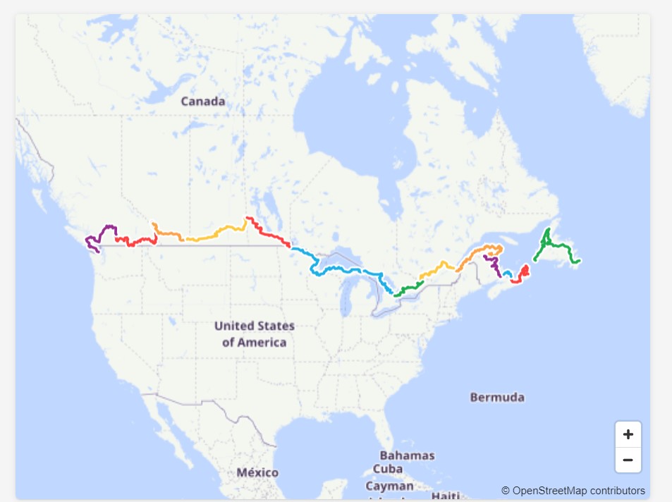
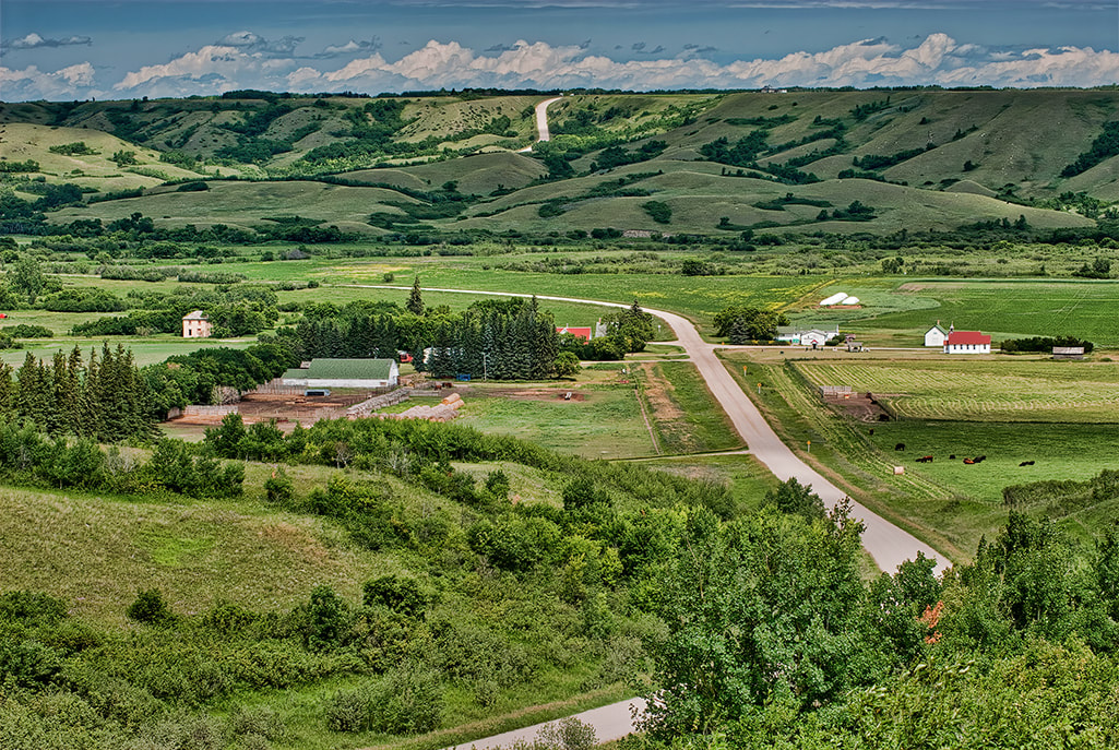
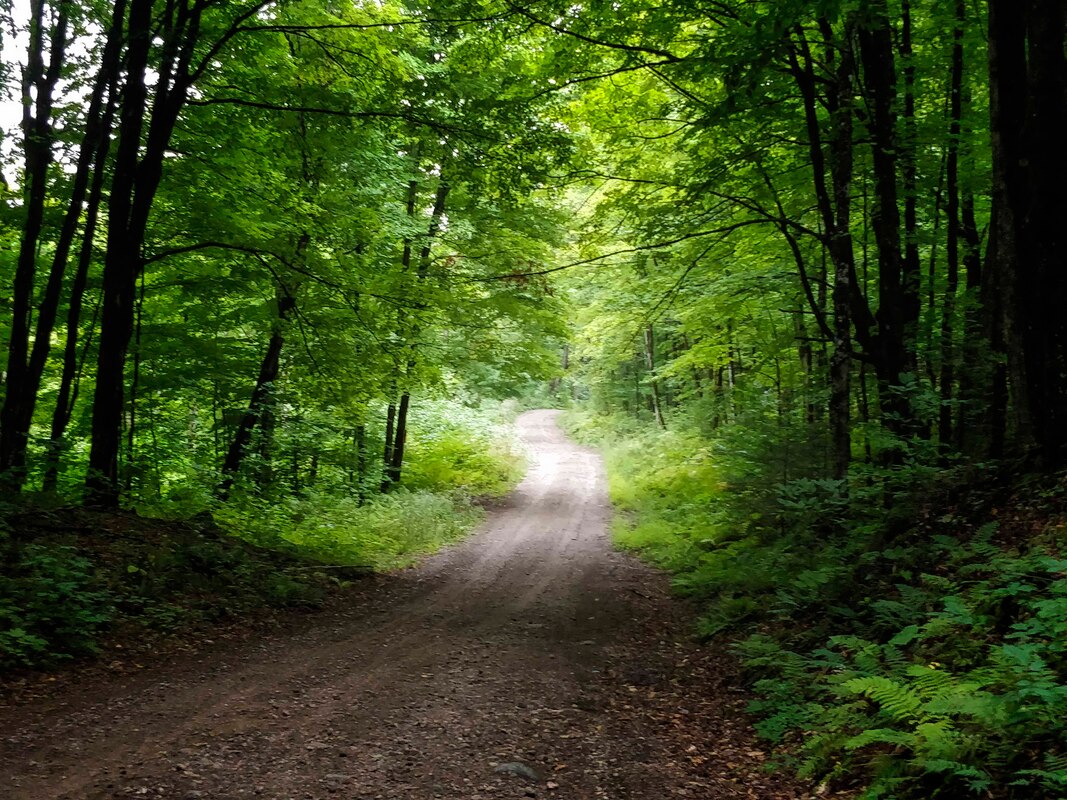
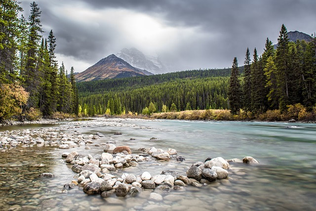
Spanning from Victoria, British Columbia to St. John’s, Newfoundland, on the GNBR riders can expect to come across nearly every imaginable riding terrain and topography– gravel and backcountry dirt roads, easy to intermediate singletrack, rail trails, forest paths through thick woods, pavement, big mountains, deep forest, prairie lands, rushing rivers, you name it. Some areas are nearly effortlessly flat while other sections will make you beg for easier gearing. The route, which is composed of 11 segments, is designed to take riders through numerous national parks, provincial parks and state forests for a sensory overload of ecozones. Riders should expect each province and US state to have its own style of riding. Consider this a true multi-surface adventure.
The GNBR starts with a bang in the mountains and wild landscapes of British Columbia and Alberta before dropping riders into the flatter lands of the prairies (Alberta, Saskatchewan, Manitoba) and then heading into the more forested environments of the US, Ontario and Quebec. Canada’s Maritimes delivers a potpourri of rugged coastline, verdant acreage and welcoming communities. The diversity of topography is unsurpassed by any other route.
Riders can attempt to complete the route in one long, brag-worthy journey or choose to tackle any of the sections individually. Or use the route as a reference for smaller rides and a lifetime of two-wheel adventures. Taking on a challenging route of this length all at once may not be sustainable for the majority of bikepackers. But complete it one go and you'll have bikepacking bragging rights that are nearly unmatched.
Why would a trans-Canada route go into the US? Riders who have crossed Canada on bikes have always had to survive the endless miles of busy highway riding in Northerwestern Ontario. This is generally a miserable experience, even if the scenery at times is fetching. (Of note: The Great Trail (aka Trans Canada trail) actually uses waterways instead of land surfaces in this area of the country as the trail would need to be on the Trans Canada Hwy which is not ideal or very safe.) The GNBR solves this problem by trading in the transport trucks and wandering RVs for much more sublime forestry roads and trails in the US portion of the route. We believe this is a major upgrade to the traditional coast-to-coast ride. So don’t forget to pack your passport.
On the following pages, you will find route files for 11 segments - 10 provinces and the U.S. portion of the route through Minnesota, Wisconsin and Michigan.
For the most part, there are frequent resupply options on this route and it’s rare to go more than 200km without being able to find services.
When to Ride
For a route this long that covers such a vast array of environments and climate zones, it’s hard to pick a perfect time to complete the route. Factor in your ride pace and tolerance for weather conditions (blazing hot, or uncomfortably cold) when deciding to commence a through-ride. In general, GNBR can be tackled from May to October. You could decide to leave Victoria in late May and still be able to make it to the east coast before the deep cold settles in. But riders may want to choose their trip time based on the sections of the route they plan on riding. For instance, the prairies can be more pleasant in the spring and fall, while the higher elevations of the Rockies may demand a summer journey depending on winter snow accumulation. Increasingly, Ontario and Quebec are experiencing great riding conditions well into October. Expect the weather to be fickle and as we are now seeing to be more unpredictable than ever.
Route Difficulty
It’s nearly impossible to clearly state the difficulty of this route because of just how varied it is as you travel from one side of the country to the next. There are demanding sections like those snippets of hike-a-bike and killer inclines and much less arduous parts such as smooth rail trails. Weather, fitness and speed of riding (sleep deprived or not) will also play a role in how demanding the route is. Overall, consider this a true adventure and one that will surely test you physically and mentally on more than one occasion.
Since this is an adventure bikepacking route, you should always expect the unexpected. Not all segments will work out as planned. Snow, high water crossings, road and bridge damage, deadfall trees, wildfires, land ownership changes and a robust weed season can turn what was a passable section into something that requires a diversion. Bears and other wildlife are present on the route as well. You didn't choose to cycle across North America for a tame environment did you?
Cell service will be limited at various points throughout the route, so a satellite communication device is your best bet to stay in contact or get help should an emergency situation occur.
How Long
The time it will take to complete the route is highly individual based on distance and speed goals. Overall, expect to take at least 3 months to complete the route if pushing a fairly good pace with few rest days. Up to 5 months allows for a more touring pace, increased rest days and a bit less suffering in the saddle. After all, you have been looking for an excuse to quit your job.
GPS Route Files
Each province and US portion of the route has its own gps route file. There are 11 segments in total. It’s not possible to combine the entire route into one file and have it manageable on devices. You’ll notice that these routes have numerous Points of Interest including locations for campgrounds and food to help you plan your trip. But this is not an exhaustive list of services on the routes. Here is a tutorial from Ride with GPS on how to best manage route files for navigation: https://ridewithgps.com/journal/7347-customize-your-bikepacking-com-adventure
If you require additional assistance on how best to navigate this route, please get in touch.
Route Direction
The GNBR is plotted to move riders from west to east, but certainly as a whole or as individual segments it can be reversed. As a rule, the predominant wind direction across the prairies is from the west, but this is known to change.
Route Alternatives
You’ll notice that for each of the segments, the route file presents several options for riders to deviate from the main route. These are presented as a Control point of interest on the route file. This can allow riders to take advantage of easier or shorter options if feeling less adventurous. There are also alternatives that give riders a more demanding option.
What Bike?
It’s a big decision, but deciding on the best type of bike to tackle this mammoth route is tricky. Bike recommendations for the GNBR are more about comfort than anything specific; so most off-road capable bikes should suffice. There is no perfect bike for a route this long that moves through so many different riding terrains. At times you’ll feel like you are overbiked and at other times underbiked. Overall, it’s advised to tackle the route on a more beefy set-up than a fast gravel bike to better handle the vast array of riding surfaces. A bike more focused toward rugged gravel and mountain biking with bikepacking style luggage will allow you to better enjoy the journey. For reference, you can view the bikepacking.com rigs for events such as the Atlas Race, Arkansas High Country and Tour Divide as examples of good set-ups for this route.
Accommodation
Where you want to rest your head a night is completely up to you. Options include paid campgrounds, “wild” camping where appropriate, motels, resorts, Warmshowers and Hipcamp listings. The iOverlander site can be a great resource for locating camping spots and they have an excellent app. Campedium (app also available) and Freecampsites.net are other useful sites for locating camping areas along the route in Canada and the US.
Be Bear Aware
A huge swath of this route takes place in bear country (grizzles and black) so be sure to take the necessary precautions. This includes bringing along bear spray and never keeping food in your tent.
Route Changes
Although all attempts will be made to scout every inch of this route at least once, land access rights, acts of weather and local laws can change route access. If you encounter any issues with the route that demand alterations please let us know through the contact form. And if you’re local to a part of this route and you know of an alternative, better routing option then again please let us know.
How to Ride
How to ride the route? Let’s go with the acronym DIAWYL – Do It Any Way You Like. (Thank you Patrick from Bikes or Death podcast for putting this out there.) Ride solo, ride with a group. Ride fast, ride very slow. Ride with a media crew, ride without any social media presence. Ride with a sag wagon, ride only self-supported. How you want to take on this route is all up to you and don’t let yourself feel pressured to take a different path. Just be respectful of the land and communities you are passing through. Here is an excellent visual explanation from Bikepacking Roots on how to properly Leave no Trace.
For the epic of all epic rides, it is possible to connect the GNBR with the Eastern Divide Trail for a nearly 20,000km sojourn.
As you ride any portion of the GNBR ask yourself whose Traditional Territory you are riding through and then recognize and reflect on that. We should acknowledge the enduring presence and deep traditional knowledge and philosophies of the Indigenous People with whom we share this land today. Indigenous peoples have lived on these lands and nurtured them long before bikepackers arrived.
To learn more about the sport of bikepacking including how to choose a bike and what to pack for your journey this Bikepacking Handbook from bikepacking.com is the ultimate resource.
If you want to stay well fueled on your journey without relying on gas station grub and freeze-dried meals in a bag, check out the Bikepacking Cookbook.
It must be stressed that the route is entirely unsupported and unsanctioned with no insurance provided. All types of bicycle riding are inherently dangerous activities, bikepacking included. All riders are responsible for their own well-being on the GNBR route and ride at their own risk. The route developer takes no responsibility for personal injury, damage to personal property or any other circumstance that might happen to individual riders cycling the GNBR route. By riding any portion of the route, you agree for yourself, your heirs, executors and administrators to waive any and all claims for personal injury and/or damage that you may have against the route developers for any and all injuries received while taking part in any and all activities. There is no guarantee of route conditions at any given time and the route developer takes no responsibility for disrupted route conditions. You are entirely responsible for your own safety and decisions that are made including accommodation and necessary detours. It is advised to study the route map and make note of your supply options as well as some possible detours (these are marked with a Control Point symbol). If you are not comfortable riding a section of the route take any necessary alternatives. Planning and due diligence is imperative as is riding within your means. People "racing" the route do so at their own risk.


